
THE ‘HEADS
Mapping home - Parua Bay and Whangarei Heads

Parua Bay & Whangarei Heads Map - A Love Letter to Home
Hand-drawn New Zealand map art celebrating the places where memories are made
Home is where the art is.
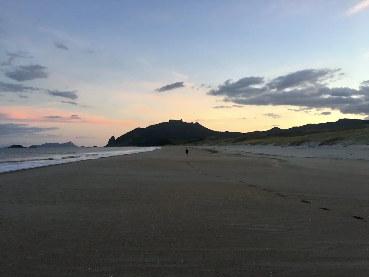
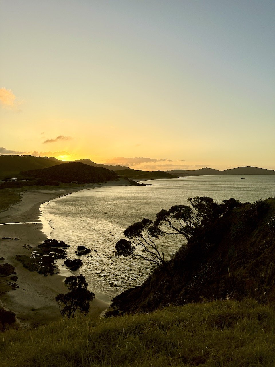
The journey starts here, I grew up in Parua Bay and I live in Parua Bay again today. I caught my first wave at Ocean Beach and my first snapper off Busby Head. As a kid I caught kingfish and explored the nooks and crannies of the Whangarei Harbour in a 12' tinny. We'd jump off the Pataua footbridge and body surf out at Kauri Mountain. Getting pipis and cockles, scallops and mussels, smashing oysters off the rocks, riding motorbikes, doing skids in paddocks in a Mazda 808 station wagon, hiking up the streams, finding golf balls and selling them at the golf course, spending the profits at the dairy on lollies, throwing eggs at the the raft race and just going and getting lost in the bush. Always barefoot, just like my kids here today.
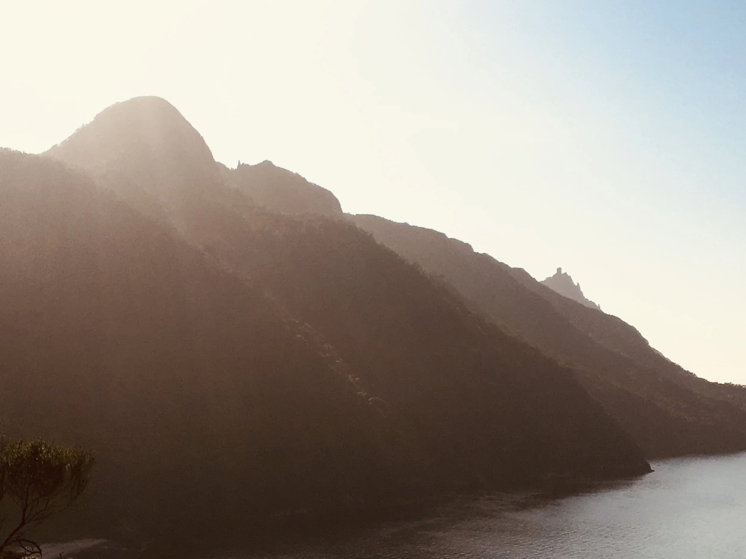
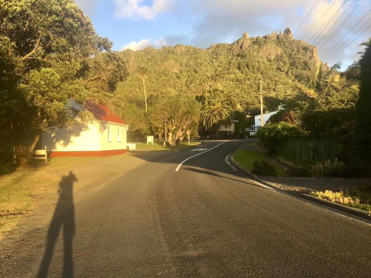
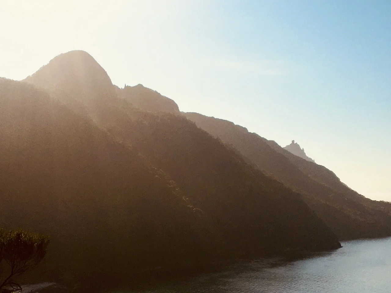
These childhood reflections combined with raising my kids here now and watching them create similar memories laid the foundation. But it was during the first Covid lockdown in 2020 that I actually started drawing a local map. I was fascinated by the fact that the rain that often falls on the roof of my house in Parua Bay Village flows out through the Pataua estuary, not the much closer Whangarei Harbour. We are connected, and I love that. A lot of water has flowed under the Pataua footbridge since then. A lot of things have changed and a lot of things remain unchanged. These volcanic peaks etched into our skyline, that form the backdrop of our daily lives are 20 million years old for example.
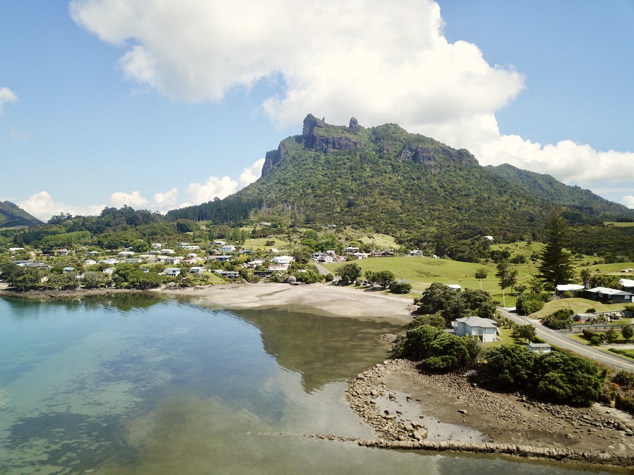
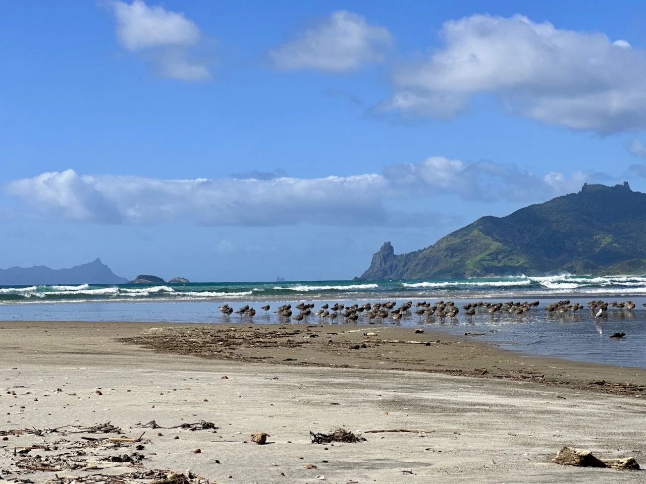
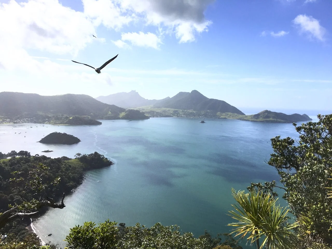
This map is loaded with the local goods: the amazing beaches and walking trails winding up Mt Manaia, Te Whara Bream Head, Peach Cove, Smugglers Bay and Reotahi. The beautiful beaches, the pohutukawa, kauri, nikau and puriri. We are spoilt for choice. This map really is about water flow though, and the diversity of water that we have here that connects all of us - Parua Bay, the Nook, McLeod Bay, Reotahi, Little Munro Bay, Taurikura, Urquharts Bay, Smugglers Bay and around to Ocean Beach and Kauri Mountain, and towards Taiharuru and Pataua.
The BB Map of Parua Bay and Whangarei Heads including the catchments of Pataua and Taiharuru is my map-based love letter to Manaia and surrounding areas. It's a sense-of-place map that seeks to show what this place feels like, and to inspire deeper understanding and sense of belonging based on my experience.
I have memories in every inch of this map, and I want to share this with you as a keepsake to hold and share your own memories of this beautiful area. Not all of my maps can I say this about, but I actually live in this map.
Why This Map Makes the Perfect Local Gift
Whether you're a local wanting to celebrate your connection to Parua Bay, Pataua, Taiharuru or Whangarei Heads, someone who grew up here and moved away, just starting your own journey here or you're looking for a meaningful New Zealand gift that captures a specific place, this hand-drawn map artwork tells a unique story of our special corner of Northland.
[Shop the BB Map of the HEADS Unframed Print →]
[Shop the BB Map of the HEADS Framed Print →]
Product Details
Hand-drawn map art of Parua Bay, Whangarei Heads & surrounding areas
Map drawn in Parua Bay, printed to order in Auckland
Features local landmarks: Mt Manaia, Bream Head, Ocean Beach, Pataua, and more
Shows unique water catchment systems connecting our communities
Created by local artist API who lives in the map
Perfect as a gift for locals, former residents, or anyone who loves this area
Ships throughout New Zealand
Cartographer: API | Parua Bay, Whangarei, Northland, New Zealand


Shop BB Map of the HEADS Prints
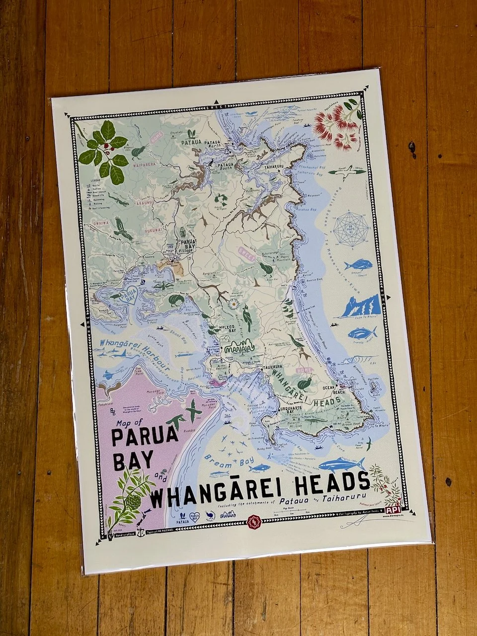
BB Map of Parua Bay and Whangārei Heads Including Pataua and Taiharuru Unframed Print
When hanging on your wall, you’ll be reminded of…
The majesty of Manaia and its surrounds: the Whangarei Heads peninsula, the Whangarei Harbour, the winding creeks, streams, and estuaries. Admiring the view as you drive along beside the harbour, being stuck behind someone else driving slowly and admiring the view along the harbour. When we used to get scallops, going to Parua Bay and Whangarei Heads school, going into town on the school bus… The pohutukawas flowering at Christmas time, the halls, the beachy settlements, the waves at the ocean, the view from Kauri Mountain, Smugglers Loop swims. The totara in the grassy paddocks, the herons stalking the water's edge, people dropping bombs and doing manu’s off the Pataua footbridge, the beaches, dramatic volcanic outline shapes. Boats launching, the fish jumping, the kiwi calling, the kākā screeching, the snapper you lost last time you were fishing. The peacefulness, the volcanic landscape, the rural character, and the beauty of the Heads.
Cartographer’s Notes
It is my map-based love letter to Manaia and surrounding areas. It is a sense-of-place map that seeks to show what this place feels like. To inspire deeper understanding and sense of belonging.
I grew up here in Parua Bay and am bringing my kids up here now. I have memories in every nook and cranny and want to share this with you.
During the first Covid lockdown I started on this map, fascinated by the fact that the rain that often falls on the roof of my house in Parua Bay Village flows out through the Pataua estuary, not the much closer Whangarei Harbour, we are connected. A lot of water has flowed under the Pataua footbridge since then.
Not all of my maps i can say this, but I actually live in this map“ - API
Please note: NZ Shipping only
Contact hello@brokerbrothers.co.nz for Australia and rest of the world shipping of unframed prints via special order : ).
Map Print Details:
BB Home Sweet Home Series
Map drawn in Parua Bay
Printed, framed and shipped Ponsonby, Auckland
100% hand-crafted, original and authentic
A2 Dimensions 420mm x 594mm
Typeset in BB Waitangi my bespoke hand-crafted typeface
Available framed or unframed
Premium art print - Giclee Printed to order on 210GSM matt art stock
Special order prints, map customisations and framing options available
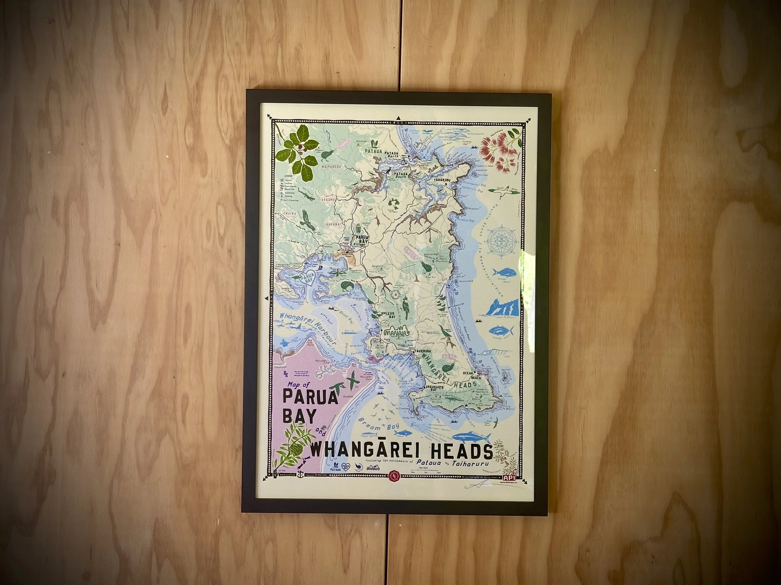
BB Map of Parua Bay and Whangārei Heads Including Pataua and Taiharuru Framed Print
When hanging on your wall, you’ll be reminded of…
The majesty of Manaia and its surrounds: the Whangarei Heads peninsula, the Whangarei Harbour, the winding creeks, streams, and estuaries. Admiring the view as you drive along beside the harbour, being stuck behind someone else driving slowly and admiring the view along the harbour. When we used to get scallops, going to Parua Bay and Whangarei Heads school, going into town on the school bus… The pohutukawas flowering at Christmas time, the halls, the beachy settlements, the waves at the ocean, the view from Kauri Mountain, Smugglers Loop swims. The totara in the grassy paddocks, the herons stalking the water's edge, people dropping bombs and doing manu’s off the Pataua footbridge, the beaches, dramatic volcanic outline shapes. Boats launching, the fish jumping, the kiwi calling, the kākā screeching, the snapper you lost last time you were fishing. The peacefulness, the volcanic landscape, the rural character, and the beauty of the Heads.
Cartographer’s Notes
This is my map-based love letter to Manaia and surrounding areas. It is a sense-of-place map that seeks to show what this place feels like. To inspire deeper understanding and sense of belonging.
I grew up here in Parua Bay and am bringing my kids up here now. I have memories in every nook and cranny and want to share this with you.
During the first Covid lockdown I started on this map, fascinated by the fact that the rain that often falls on the roof of my house in Parua Bay Village flows out through the Pataua estuary, not the much closer Whangarei Harbour, we are connected. A lot of water has flowed under the Pataua footbridge since then.
Not all of my maps i can say this, but I actually live in this map - API
Overseas customers:
Only unframed prints can be shipped overseas.
Quality Frame:
Ready to hang, made of solid wood, glass and all fittings, just choose you colour, black, white or natural wood.
Map Print Details:
BB Home Sweet Home Series
Map drawn in Parua Bay
Printed, framed and shipped Ponsonby, Auckland
100% hand-crafted, original and authentic
A2 Dimensions 420mm x 594mm
Typeset in BB Waitangi my bespoke hand-crafted typeface
Available framed or unframed
Premium art print - Giclee Printed to order on 210GSM matt art stock
Special order prints, map customisations and framing options available
Framed prints can only be shipped to addresses within New Zealand
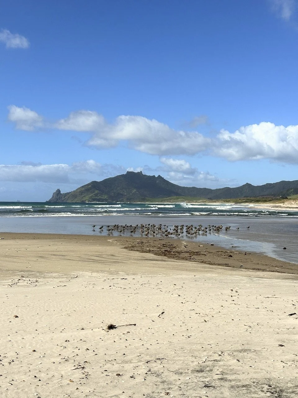
BB Map of the 'HEADS - Ocean Beach
BB Map of the 'HEADS - Te Whara Bream Head

BB Map of the 'HEADS - Parua Bay detail
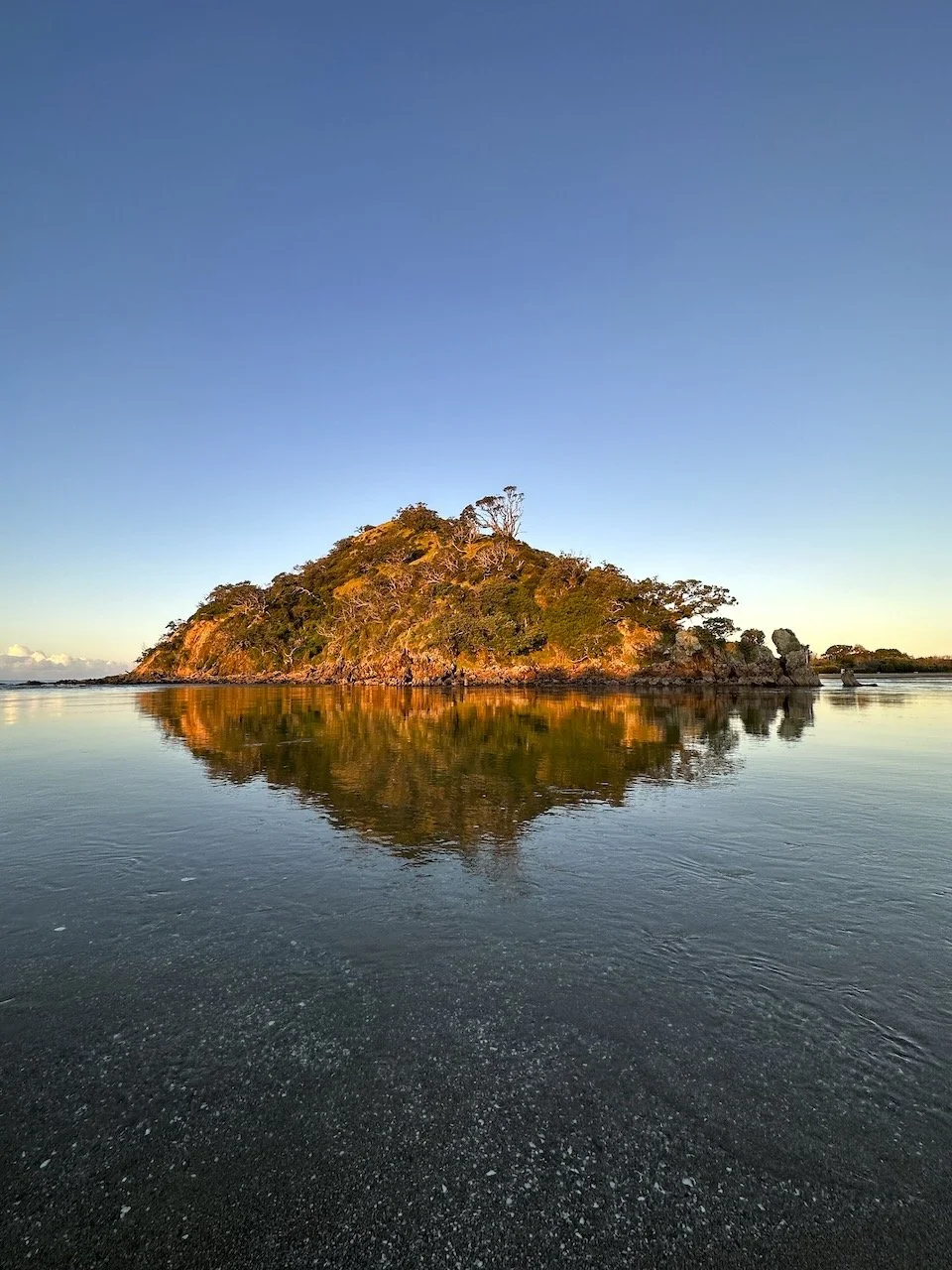
BB Map of the 'HEADS - Pataua Island
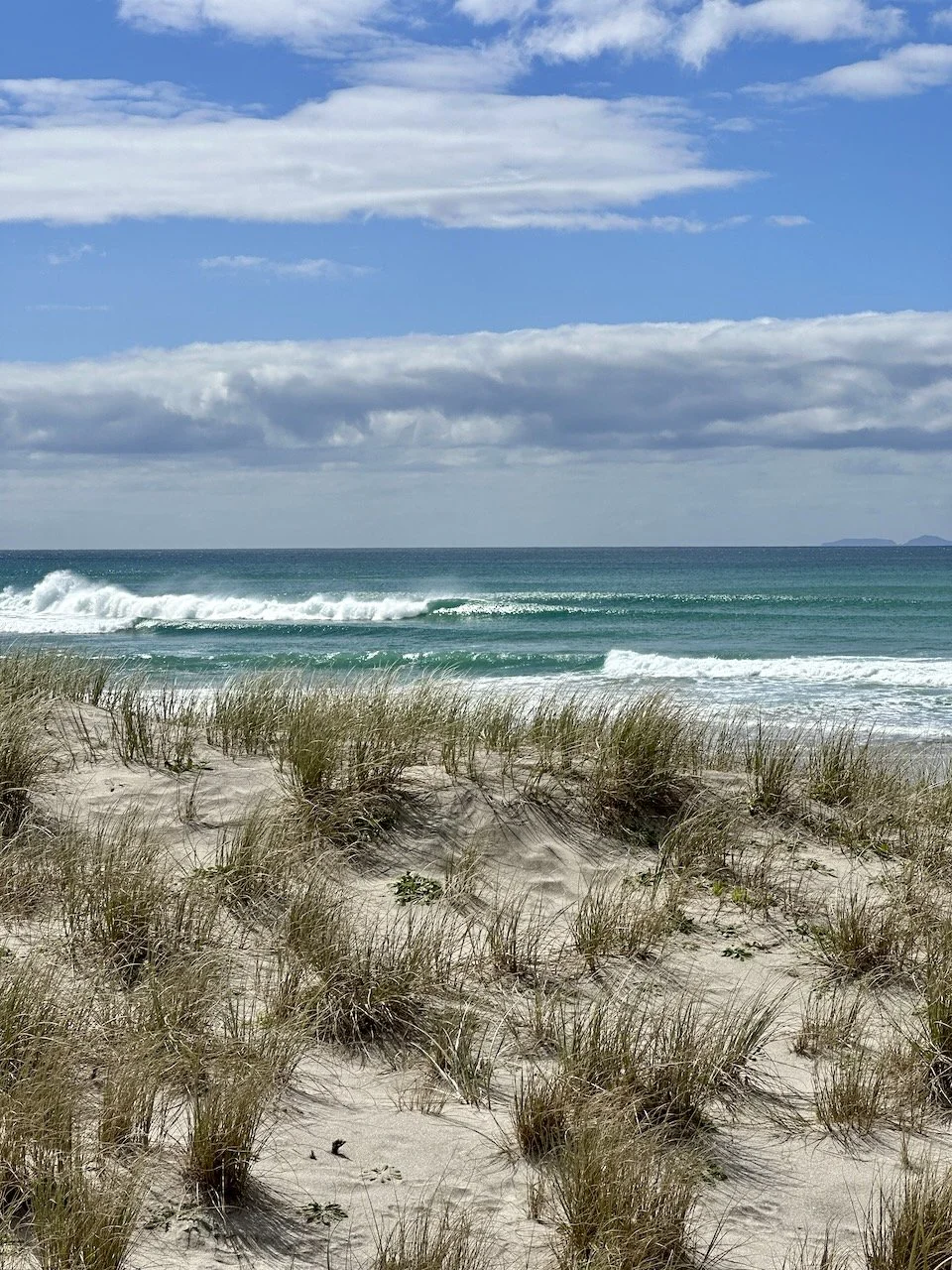
BB Map of the 'HEADS - Kauri Mountain Beach

BB Map of the 'HEADS - BB Wall Hanger SOLD OUT

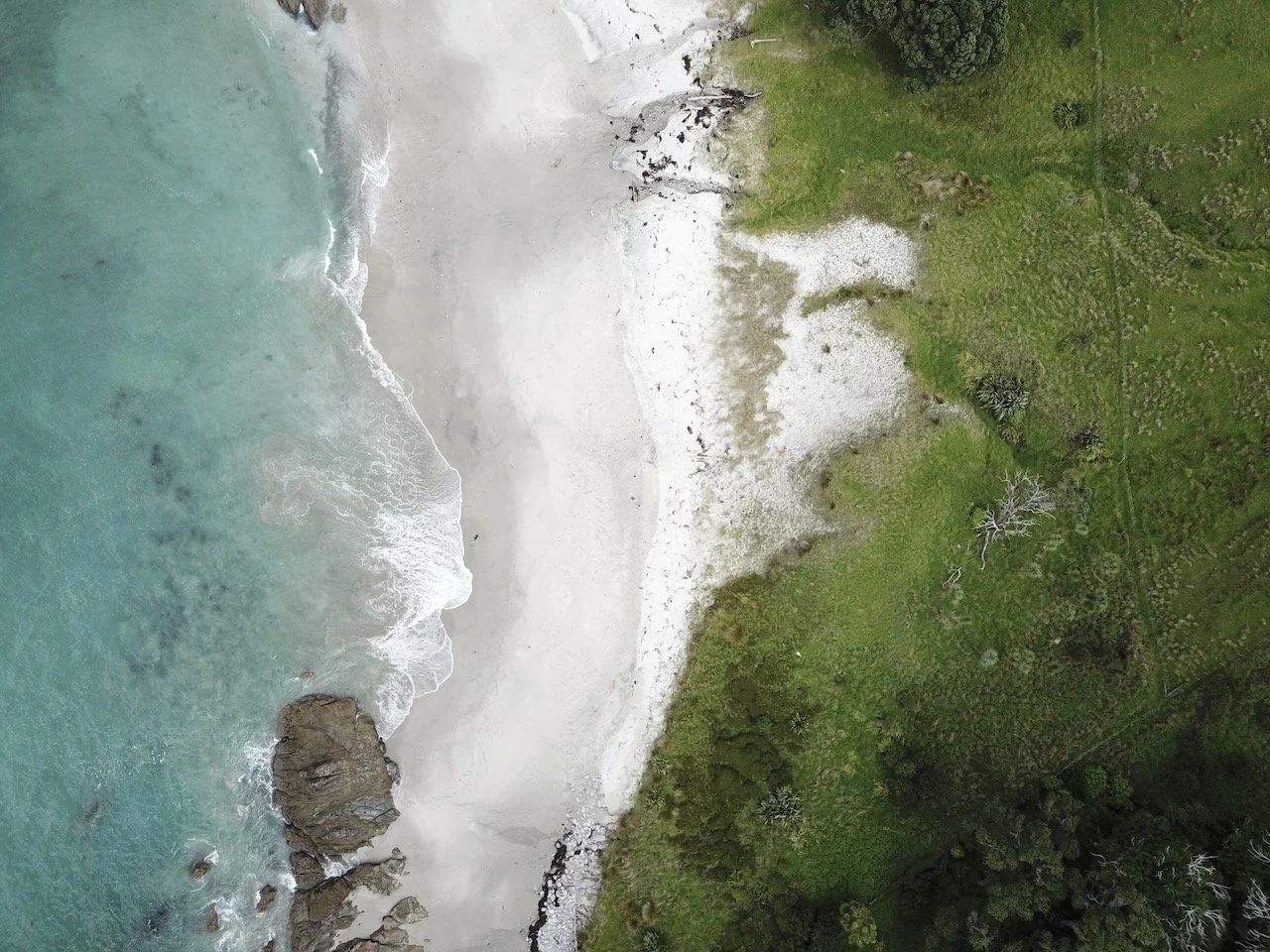
BB Map of the 'HEADS - Harbour Entrance Detail

BB Map of the 'HEADS - Pataua Detail
BB Map of the 'HEADS - Smugglers Bay
BB Map of the 'HEADS - Azza 1's OB's Good Surf Now!

BB Map of the 'HEADS - Manaia Detail