
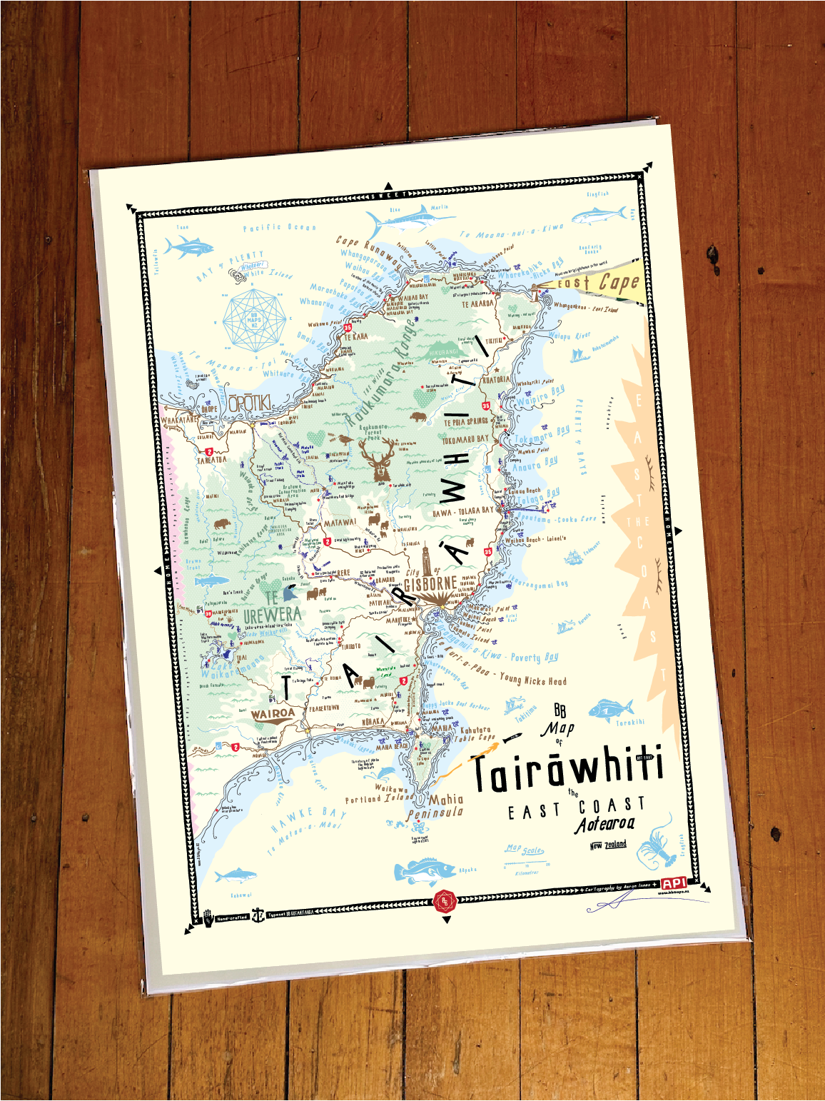
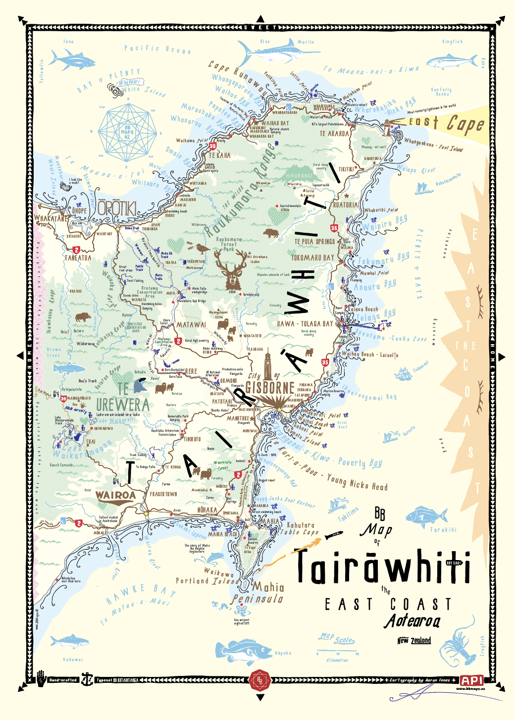
BB Map of Tairāwhiti the East Coast Unframed Print
When hanging on your wall, you’ll be reminded of…
The glory of Tairāwhiti, and spying the sun peeking over the horizon before anyone else, the rural landscapes, the endless waves, the endless interior hills and ranges, the coastal communities, the carved meeting houses and beautiful marae, the wilds of Raukumara and Te Urewera, the Waioeka Gorge with its endless turns, the sheep baa'ing, the hunters hunting, the surfers surfing, that thin line where the ocean meets the land, Mahia Peninsula, the pohutukawa-fringed Eastern Bay of Plenty, the mighty Maunga Hikurangi, the East Cape and the road trip gem that is State Highway 35, Lake Waikaremoana and the serenity of the beech forests, SH38 and its wilderness feelings, all the beautiful things - Out East.
Cartographer’s Notes:
This is a version of the very first BB Map, hand-drawn in Okitu and Makorori Beach ~ 2010. It was created as a visual representation of what the Tairāwhiti region felt like to me, the places I explored, the people I met, the waves I surfed etc. It's a beautiful map and versions have been used to promote the region since 2010. It is typeset in BB Kotahitanga, a typeface I hand-crafted during that same period, inspired by local character buildings.
Please note: NZ Shipping only
Contact hello@brokerbrothers.co.nz for Australia and rest of the world shipping of unframed prints via special order : ).
Map Print Details:
BB Home Sweet Home Series
Original map drawn in Okitu and Makorori, updated in Parua Bay
Printed, framed and shipped Ponsonby, Auckland
100% hand-crafted, original and authentic
A2 Dimensions 420mm x 594mm
Typeset in BB Kotahitanga and BB Waitangi and my bespoke hand-crafted typeface
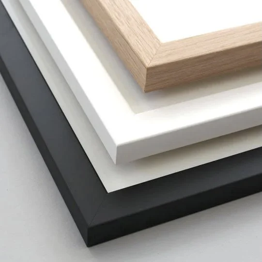
Available framed or unframed
Premium art print - Giclee Printed to order on 210GSM matt art stock
Special order prints, map customisations and framing options available
Special thanks to Cy for all his help in the creation of this map and helping me explore so much of the region
BB Map of Tairāwhiti the East Coast Unframed Print
When hanging on your wall, you’ll be reminded of…
The glory of Tairāwhiti, and spying the sun peeking over the horizon before anyone else, the rural landscapes, the endless waves, the endless interior hills and ranges, the coastal communities, the carved meeting houses and beautiful marae, the wilds of Raukumara and Te Urewera, the Waioeka Gorge with its endless turns, the sheep baa'ing, the hunters hunting, the surfers surfing, that thin line where the ocean meets the land, Mahia Peninsula, the pohutukawa-fringed Eastern Bay of Plenty, the mighty Maunga Hikurangi, the East Cape and the road trip gem that is State Highway 35, Lake Waikaremoana and the serenity of the beech forests, SH38 and its wilderness feelings, all the beautiful things - Out East.
Cartographer’s Notes:
This is a version of the very first BB Map, hand-drawn in Okitu and Makorori Beach ~ 2010. It was created as a visual representation of what the Tairāwhiti region felt like to me, the places I explored, the people I met, the waves I surfed etc. It's a beautiful map and versions have been used to promote the region since 2010. It is typeset in BB Kotahitanga, a typeface I hand-crafted during that same period, inspired by local character buildings.
Please note: NZ Shipping only
Contact hello@brokerbrothers.co.nz for Australia and rest of the world shipping of unframed prints via special order : ).
Map Print Details:
BB Home Sweet Home Series
Original map drawn in Okitu and Makorori, updated in Parua Bay
Printed, framed and shipped Ponsonby, Auckland
100% hand-crafted, original and authentic
A2 Dimensions 420mm x 594mm
Typeset in BB Kotahitanga and BB Waitangi and my bespoke hand-crafted typeface
Available framed or unframed
Premium art print - Giclee Printed to order on 210GSM matt art stock
Special order prints, map customisations and framing options available
Special thanks to Cy for all his help in the creation of this map and helping me explore so much of the region